-40%
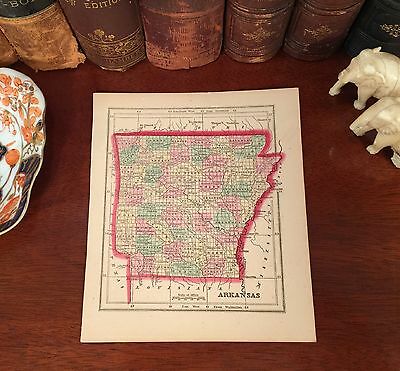
Original Hand-Colored 1856 Antique Pre-Civil War Map ARKANSAS Little Rock Rogers
$ 63.02
- Description
- Size Guide
Description
Fine Adornment of History. Highly-Prized Morse & Gaston Map. Great for Genealogy. Imaginative & Creative Gift.1856 Map of Arkansas
Hand-Colored. Gilt Edged.
Copper Plate Engraved.
Original 1856. 161-yrs-old.
M
ap is in Very Good condition. No
folds, marks, tears, or writings. Mild foxing. Nominal fraying.
Not a Reproduction.
Original Map Engraved on Copper-Plate for the 1856 Edition of The Diamond Atlas, American Edition, With Descriptions of All Countries: Exhibiting Their Actual and Comparative Extent, and Their Present Political Divisions, Founded on the Most Recent Discoveries and Rectifications; By Charles Colby, A.M., Editor of "Morse's General Atlas of the World;" The Western
Hemisphere;
Published 1856 by Morse & Gaston: New York, 115 and 117 Nassau, and 15 Spruce Streets; MDCCCLVI;
a copy of the Title Page of which is Included
.
Impressive On Any
Home or Office Wall
Dimensions: 6" x 7"
Fine Adornment of
Arkansas History
Great for History and Family Genealogy, as Map shows Cities, Towns, & Landmarks of 1856, Some of Which No Longer Exist Today.
A Rare and Highly-Prized Hand-Colored Map of American History, Copper-Plate Engraved on Gilt-Edged Paper, Published Five Years Before the Start of the Civil War.
Complete Editions of Morse & Gaston's Atlas Are Quite Desirable and Tend Towards the Top-End of American Atlases.
Exquisite Map for the Decorator, Historian, or Collector. Easily Framed. Makes an Imaginative & Creative Gift.
Visit My eBay Store: Atticus Hutchinson Antiques
Free Shipping Special.
Maps are mailed the day after purchase & normally arrive within 2-3 days. All Credit & Debit Cards accepted through Paypal. Please email with any questions.
Greetings from Historical Savannah, Georgia: Founded 1733.
Press the Store Link Above for More of My Collection.
"Some, to beautify their parlors, chambers, and studies....loveth, getteth, and useth maps, charts, and geographical globes."
- John Dee, Advisor to Queen Elizabeth I.


